Bussiness
Snow remains in northern England with rain hitting the south – London Business News | Londonlovesbusiness.com

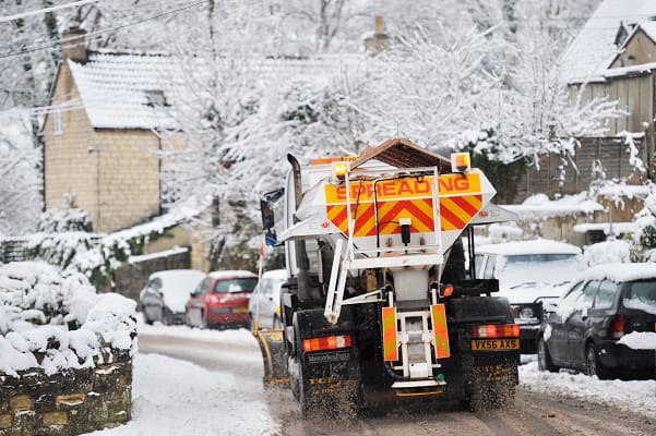
On Sunday snow will turn into rain for most of the UK and in northern England snow will continue to accumulate on higher ground and snow will move to parts of Scotland.
17 cm of snow had accumulated at Bingley in West Yorkshire by 11:00 on Sunday, with 10 cm at Shap in Cumbria. Snow accumulations have also been recorded more widely across England and Wales away from the far south, although many southern areas are now much milder.
With an Amber warning for snow still in force for Northern England until midnight tonight, accumulations are forecast to continue to build over the Pennines through Sunday.
Through Sunday and into Monday morning further snow showers and the risk of ice continue in much of Scotland. Yellow weather warnings have been issued here, as well as for Northern Ireland.
Milder air has moved north across the southern half of the UK overnight, with a stark contrast in temperatures.
The Isles of Scilly recorded a low of 13.2°C overnight, while the lowest temperature was recorded at Loch Glascarnoch where temperatures dropped to -11.1°C. As the milder air moves north there could be a difference of 6-9°C within just 50 miles or so, this boundary probably somewhere over the north Midlands.
Met Office Chief forecaster Frank Saunders, said: “We’re seeing snow accumulations building in the expected areas covered by the Amber warning and there will be further snowfall over the higher ground in northern England throughout today, probably turning heavier again this evening. Cold conditions in Scotland will continue, with snow showers in many coastal areas, and more persistent snow for a time in the southeast.
“With mild air now across much of the southern half of the UK, rain is the main hazard here, which alongside snow melt could cause some localised flooding impacts. Yellow warnings for rain have been issued or updated, covering Wales, Cheshire, Manchester, the north Midlands and towards the Humber and, separately, for southern England.”
The milder air in the south means any precipitation will fall as rain across southern Wales and central and southern England. Combined with some melting snow in places, there is the risk of some surface water flooding with already saturated ground. Yellow weather warnings for rain have been issued.
Sarah Cook, Flood Duty Manager at the Environment Agency, said: “A combination of melting snow and rain may lead to the possibility of some significant river flooding in localised areas of Lancashire and Warwickshire on Sunday and Monday, and minor flooding from rivers and surface water may also be seen more widely across other parts of England.
“Environment Agency teams continue to be out on the ground, taking action to reduce the impact of flooding, issuing flood warnings and support those communities affected. We advise people to stay away from swollen rivers and urge people not to drive through flood water as just 30cm of flowing water is enough to move your car.
“People should search ‘check my flood risk’, sign up for free flood warnings, and keep up to date with the latest situation at @EnvAgency on X.”
Potential for snow in the south next week
As the low pressure pulls away to the east, gusty winds will move in across southeastern England and East Anglia in the early hours of Monday morning. Its movement east will also re-establish a northerly air flow across the UK, bringing cold air across the whole of the UK again with widespread frost and below average temperatures by day and night.
Deputy Chief Forecaster, Mike Silverstone, said: “The low pressure that brought the snow and heavy rain in the south will move out to the east by Monday. This will allow a cold northerly flow to become established again for much of next week. This will bring further sleet, snow and hail showers to northern Scotland in particular, but possibly to some other areas, especially near western coasts, with a fair amount of dry and bright weather elsewhere.
“Temperatures will remain below average, with widespread frost and the threat of ice at times. Some areas, especially in the north, may struggle to get above freezing for several days.
“There is also the potential for some snow in southern and maybe central parts of England and Wales around the middle of the week, as a system brushes the south, bumping into the cold air. This is however still uncertain, and we’ll continue to assess this over the coming days. Further weather warnings


